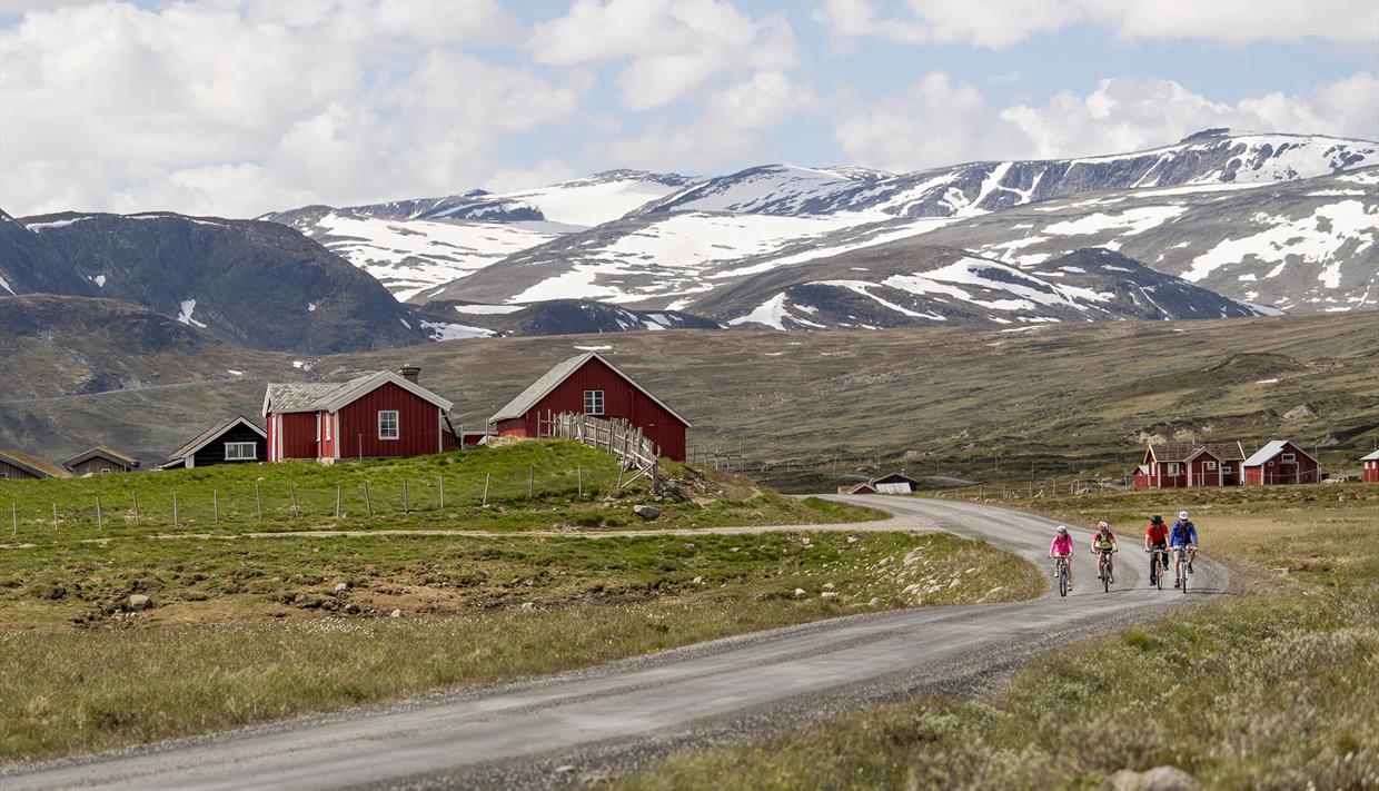
Mjølkevegen: Lemonsjø - Beitostølen via Bygdin, Tyin and Slettefjellet (ca. 200 km)
About
This version focuses on the experiences in the northern ranges of the Mjølkevegen cycling route and allows you to travel in and out of the route by bus from Oslo during the summer season. You can take the bus all the way to the starting point, Lemonsjø Fjellstue (middle og June to middle of August). Information on bus routes and timetables can be found below.
Lemonsjø - Skåbu / Ruten (59 km; 970 m elevation gain)
After a good night's sleep at Lemonsjø Fjellstue and a solid breakfast, you are ready to start cycling! Follow the driveway behind the lodge through the cabin area (turn left at the garbage containers!) and the old forest road towards Randsverk. Before you reach Randsverk Camping, turn left and follow the cycling signs through the forest until you reach the main road Heidalsvegen. Exit onto Heidalsvegen to the left and follow it for approx. 2km to the intersection with Murudalsvegen. Exit to the right onto Murudalsvegen and after 5 km, to the right again onto Nysetervegen (right after crossing over the river). Stay on Nysetervegen through the whole Murudalen valley until you reach the intersection with Jotunheimvegen. Exit to the left onto Jotunheimenvegen and follow the signage to Skåbu Fjellhotell or, alternatively, along Lake Olstappan to Ruten Fjellstue.
The friendly hosts at our accommodations will welcome you upon your arrival. Enjoy the cosy atmosphere, explore the outdoor activities and endulge in the local food!
Skåbu/Ruten - Haugseter - Bygdin (61 km; 1155 m elevation gain)
From Skåbu or Ruten, this leg will take you to Bygdin, along the idyllic Jotunheimvegen. We recommend a stop at Haugseter Fjellstue for a break, a nice meal or for an overnight. Haugseter is well known for its many nearby hiking and fishing possibilities. Keep following Jotunheimvegen and exit to the left onto the main road 51 which you follow for approx. 1 km downhill to Bygdin Høifieldshotel. Bygdin Høyfjellshotell has historical style accommodation with a prime location on the lakeshore.
In the surroundings of Bygdin there are hiking trails and the popular Synshorn Via ferrata.
Bygdin - M/B Bitihorn - Tyinholmen (boat tour + 3.5 km; 75 m elevation gain)
From Bygdin, the historical boat M/B Bitihorn will take you across the lake to Eidsbugarden. For timetable prices and online booking: https://jvb.no/en/bitihorn/ (remember to book for yourself and your bicycle!). The boat ride to Eidsbugarden takes 1 hr 45 min.
From Eidsbugarden, it's only a few kilometers to Tyinholmen Høyfjellstue. This is one of the traditional historic tourist lodges in Jotunheimen with continuous operation since 1892. Enjoy the breathtaking surroundings. We recommend to spend the afternoon with a hike to Utsikten or to explore the beautiful valley of Koldedalen on bicycle.
Tyinholmen - Tyinkrysset / Filefjellstuene (20.5 km; 185 m elevation gain)
From Tyinholmen, the route takes you along the shore of Lake Tyin. Reaching road 53, exit to the left in the direction of Tyinkrysset. After approx. 3 kilometers turn left and follow the signage via Updalsstølen until you reach Tyinkrysset. Choose this route if you are bound for Slettefjellet and Beitostølen on teh same day.
However, if you are staying for the night at Filefjellstuene, ignore the signs to the left and cintue on road 53 until your reach the old E16. Exit to the right and after approx. 400 m, to the left a short climb to the hotel Filefjellstuene. On the next day, continue uphill for a short bit to Grovstølen and turn left downhill to Tyinkrysset.
At the Filefjell Turist Office / Intersport at Tyinkrysset, you can recharge your e-bike battery. There are power outlets either inside the store or outside on the wall next to the garbage containers. Also, there are chargers available for Shimano, Bosch og Yamaha.
Tyinkrysset - Slettefjellet - Beitostølen (54 km; 1500 m elevation gain)
From Tyinkrysset, we recommend following the King’s Road instead of cycling the E16, but be prepared for some trail sections where you might have to push your bike. At the intersection with the E16, make sure you get onto Vennisvegen along the northern shoreline of Lake Vangsmjøsa. Continue on Vennisvegen and Lilagardsvegen (uphill climb) until you reach the Slettefjell toll booth/entrance to the Slettefjell mountain road. Here you find a small kiosk where you can buy refreshments and also charge your e-bike battery (against fee).
Get ready for the toughest stretch and the steepest climb on the entire route. Follow Slettefjellvegen accross the Slettefjellet mountain with the highest point at 1315 m.a.s.l. On the way up, we recommend to make a stop and stretch your legs on a 15 minutes walk for a view to the Sputrefossen waterfall (wooden sign in the second right bend after the toll booth). Once you arrive at the top of the mountain pass, the spectacular view will hopefully cover for the strenuous uphill ride. From there it’s all downhill to Lake Fleinsendin (beware that Slettefjellvegen exits to the right!) and further towards Lykkja and Beito. From Beito though, there is another 3 km climb to your final destination Beitostølen.
Turn left at the intersection at Beitostølen and you’ll see our recommended accommodation, the Beito Resort Hotel on your left. At Beitostølen you’ll also find a selection of shops, restaurants, pubs, activity providers and all types of accommodation.
_____________________________________
Transport
App/webpage for connections across different public transport providers: www.entur.no
Bus between Beitostølen and Gjendesheim: www.nor-way.no (book ahead for both yourself and your bike)
Bus between Gjendesheim and Lemonsjø: www.innlandstrafikk.no, route 204 (no prebooking available)
M/B Bitihorn across Lake Bygdin: www.jvb.no/bitihorn (book ahead for both yourself and your bike on www.nor-way.no)
This tour can be booked as a tour package with all meals, transport and baggage transport.
Bicycle rental
Rent your bike with Bike&Hike Jotunheimen at Lemonsjø or Beitostølen Rental.
FAQ
Please visit our FAQ-pages where you can find tipps and recommendations, a packing list and other useful information.


