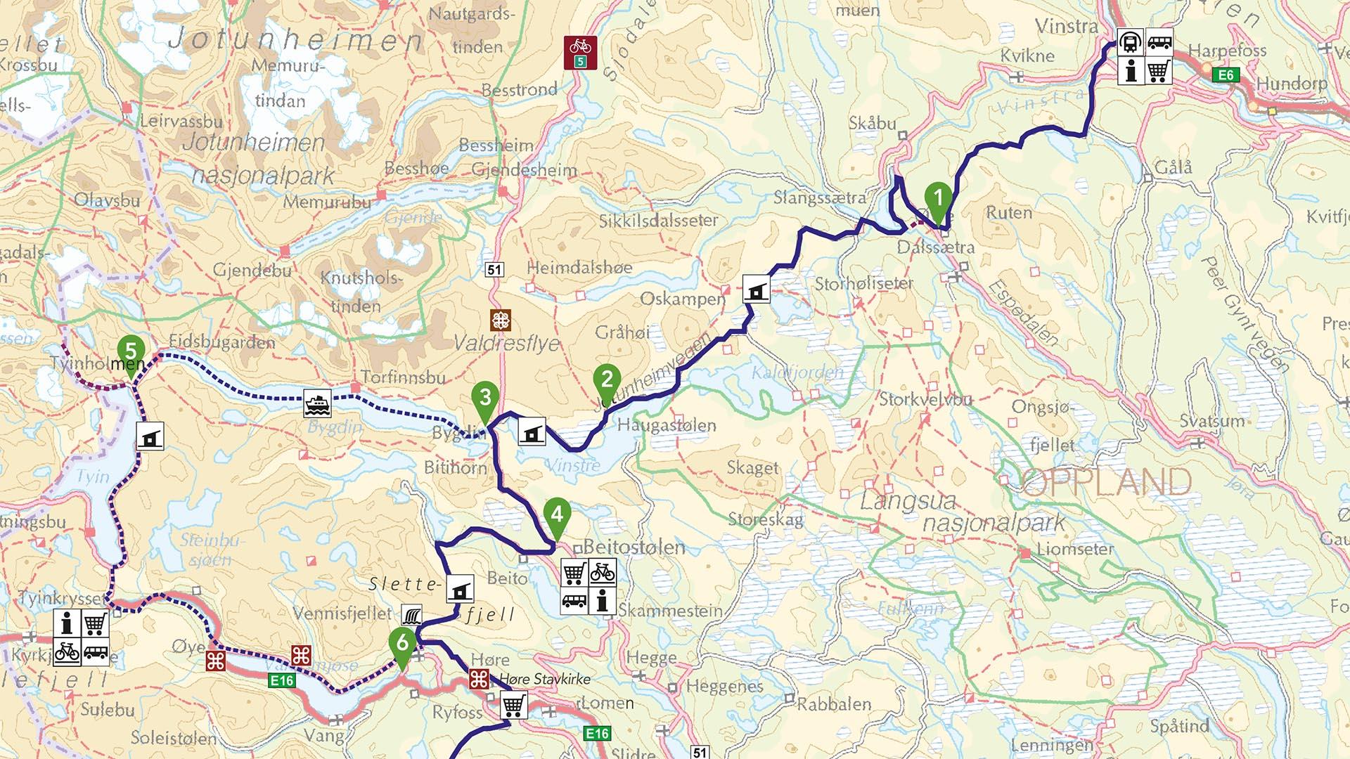
Map, downloadable information and elevation profile
Download an PDF of the map by cklicking the following link:
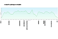
Download the route profile of the entire Mjølkevegen via Tyin by clicking the following thumbnail image:
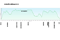
Download the route profile of the entire Mjølkevegen vis Tyin by clicking the following thumbnail image:
GPX-tracks of the entire route for downloading:
Mjølkevegen via Slettefjellet
Mjølkevegen via Tyin (NB! The track includes the boat passage. This is not to be cycled!)
If you should experience problems with the downloaded track, please contact us via email at info@visitvaldres.no and we will send the tarck to you as an attachment. This usually works.
Stages and elevation gain/loss (in meters) route 1 via Slettefjellet:
Vinstra st. – Ruten Fjellstue ca. 30 km and 1090 m up, 480 down
Vinstra st. – Skåbu Fjellhotell ca. 27,5 km and 940 m up, 320 down (country road, moderate traffic; recommended route via Peer Gyntvegen and Ruten Fjellstue)
Lemonsjø Fjellstue – Ruten Fjellstue ca. 58,5 km and 970 m up, 980 down
Lemonsjø Fjellstue – Skåbu Fjellhotell ca. 50,5 km and 820 m up, 830 down
Ruten Fjellstue – Haugseter Fjellstue ca. 47 km and 933 m up, 750 down
Skåbu Fjellhotell – Haugseter Fjellstue ca. 38,5 km and 740 m up, 565 down
Haugseter Fjellstue – Bygdin Høifieldshotel ca. 14 km and 220 m up, 190 down
Bygdin Høifieldshotel – Beitostølen (Radisson BLU / Riddergaarden) ca. 12 km and 140 m up, 310 down (road 51, traffic)
Beitostølen – Grønolen Fjellgard ca. 4 km and 20 m up, 200 down
Grønolen Fjellgard – Slettefjellkiosken ca. 21 km and 710 m up, 740 down (mest krevende etappe)
Slettefjellkiosken – Rogn Camping ca. 5 km and 240 hm down (0 up)
Slettefjellkiosken – Syndinstøga ca. 20,5 km and 670 m up, 380 down
Rogn Camping – Syndinstøga ca. 15,5 km and 630 m up, 90 down
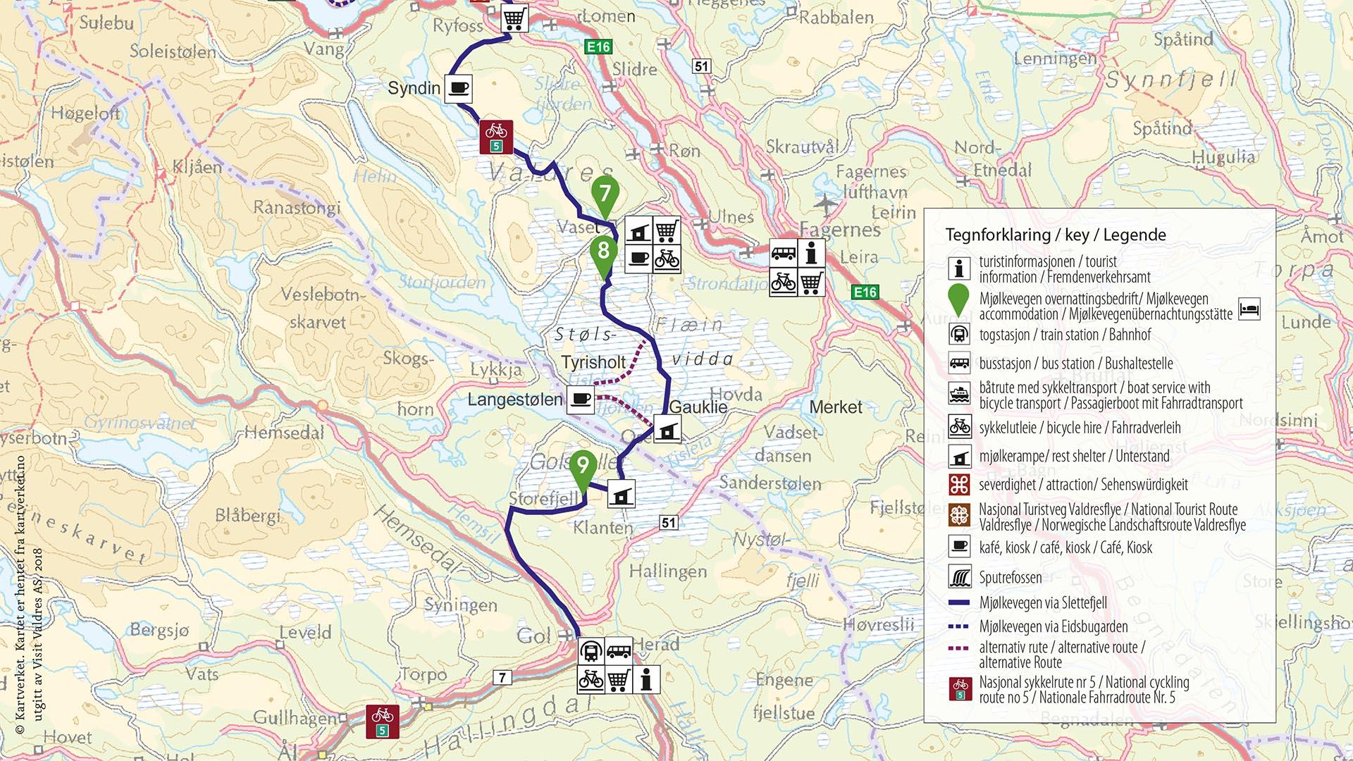
Syndinstøga – Vaset (Vasetstølen / Vasetsenteret Camping) ca. 20 km and 230 m up, 420 down (family friendly)
Vasetstølen – Gomobu Fjellstue ca. 2 km and 155 m up (0 down)
Vasetstølen – Oset Fjellhotell (via Gauklie) ca. 24 km and 380 m up, 330 down (family friendly)
Vasetstølen – Oset Fjellhotell (via Langestølen) ca. 29,5 km and 400 m up, 350 down (family friendly)
Oset Fjellhotell – Kamben Høyfjellshotell ca. 4,5 km and 110 m up, 40 down
Oset Fjellhotell – Storefjell Resort ca. 6 km and 180 m up, 40 down
Storefjell Resort – Gol st. ca. 24 km and 125 m up, 905 down
Oset Fjellhotell – Gol st. ca. 30 km and 305 m up, 945 down
Kamben Høyfjellshotell – Gol st. ca. 31 km and 185 m up, 910 down
Storefjell Resort – Fagernes ca. 47,5 km and 350 m up, 980 down
Stages and elevation gain/loss (in meters) route 2 via Tyin: (between Bygdin and Slettefjellkiosken):
Vinstra/Lemonsjø – Bygdin as above
Bygdin – Eidsbugarden (with M/B Bitihorn) 1 hour 45 min; for time table and tickets: see jvb.no/mb-bitihorn
Eidsbugarden – Tyinholmen Høyfjellsstuer ca. 3,5 km og 75 m up, 40 down
Tyinholmen Høyfjellsstuer – Tyinkrysset ca. 20.5 km og 60 hm up, 310 down
Tyinholmen Høyfjellsstuer – Filefjellstuene ca. 20,5 km og 90 m up, 260 down
Tyinkrysset – Slettefjellkiosken (via Vangsmjøse north) ca. 31 km og 420 m up, 630 down
Filefjellstuene – Slettefjellkiosken (via Vangsmjøse nord) ca. 33 km og 420 hm up, 710 hm down
Further as above (from Slettefjellkiosken)
The route in total (Vinstra-Gol via Slettefjellet): approx. 230 km and 4120 m uphill, 4150 m downhill
Paper cycling map
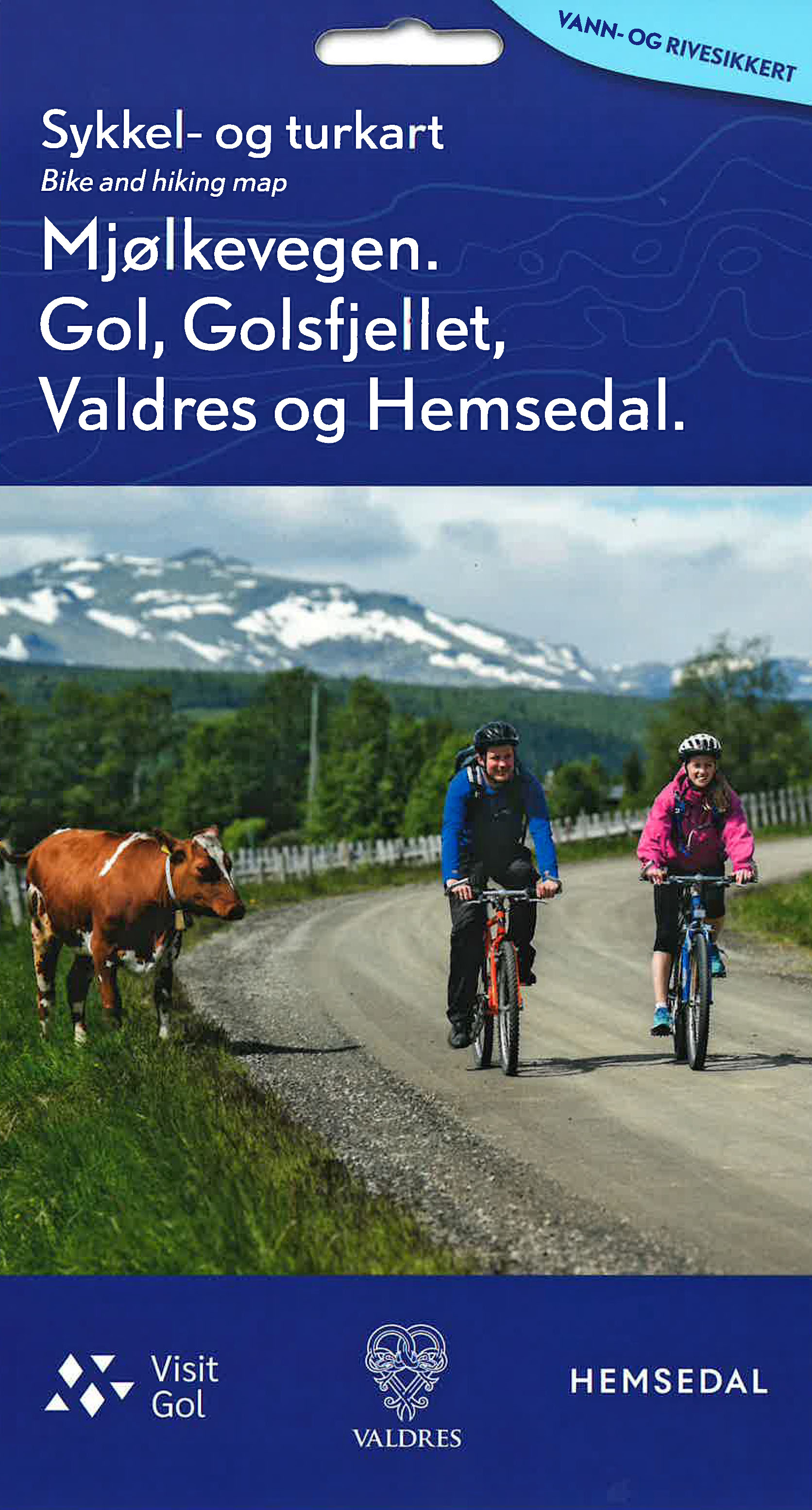
Cycling map for Mjølkevegen 1:100 000 - new 2026 edition available
.jpg)
Map published by Visit Valdres. Price: NOK 249,-
This is the recommended map for all who want to cycle the whole route or the northern parts of Mjølkevegen. The map is obtainable from the Mjølkevegen accommodations along the route, the tourist offices at Fagernes and Beitostølen, the Intersport stores belonging to Fjellkjeden (Beitostølen, Fagernes, Tyinkrysset, Vaset and Gol), the Joker supermarkeds at Vaset and in Tisleidalen as well as the Norli book store at Fagernes.
Alternative map:
Sykkel- og turkart for Mjølkevegen, Gol, Golsfjellet, Valdres og Hemsedal 1: 60 000 (Golsfjellet-Stsølsvidda) / 1: 150 000 (Mjølkevegen)
Published 2024 by Visit Golsfjellet on cooperation with Visit Gol, Visit Valdres and Visit Hemsedal.
Price: NOK 259,-
This is the recommended map for all who want to explore the southern part of Mjølkevegen and do different day tours/loops from a base. The map is obtainable from the Mjølkevegen accommodations along the southern part of the route, the tourist offices at Fagernes and Beitostølen and the Joker supermarked at Vaset.
Komoot
You can find Mjølkevegen with all route alternatives as Collection on Komoot.


Follow us on Facebook
Follow us on Instagram